Nepal Floods Update: The disaster began on the slopes of the 7,234-metre (23,733-foot) Langtang Lirung mountain, just 45 km north of Kathmandu, devastating the Nepal-Tibet border region. Satellite imagery and expert analysis show that a massive glacial avalanche was the trigger
What happened in Nepal's northern mountains on Wednesday wasn't just a flood or a landslide. It was a catastrophe so huge, even the word 'devastating' feels too small. The disaster, which started on the slopes of the 7,234-metre (23,733-foot) Langtang Lirung mountain, just 45 kilometres north of Kathmandu, has completely wrecked the Nepal-Tibet border region. According to satellite images and expert analysis, it all began with a massive glacial avalanche.
A gigantic piece of a glacier, nearly 2,000 feet wide (that's more than half a kilometre), broke off and crashed 4,000 feet down into the valley. The impact was so powerful, it's estimated to have released energy equal to about 6.3% of the Hiroshima atomic bomb, creating a shockwave equivalent to a 5.2 magnitude earthquake.
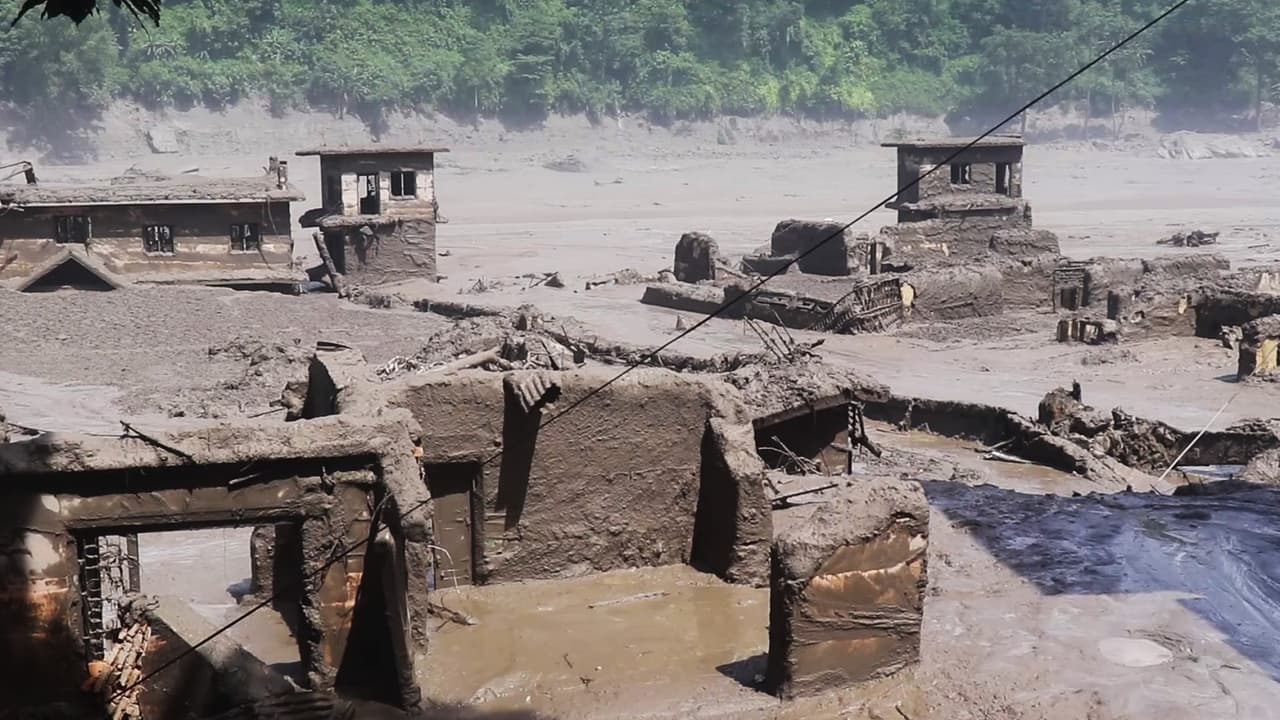
After hitting the ground, this massive pile of ice and rock turned into a 100-foot-high tsunami of water, mud, and debris. It then tore through the Trishuli River at terrifying speed. Nepal's steep and rugged mountains made the wave even more intense, turning it into a 'wall of death' for the settlements below. Experts say the avalanche happened on the northern side of Langtang Lirung. Satellite images from Google Earth and Planet Labs show that the area is covered by a huge glacier and has a history of major landslides.
Related Articles

On the same day, at 8:37 AM local time, a 4.4 magnitude earthquake was also recorded near the China border. Scientists are now debating whether the earthquake caused the slope to collapse, or if the massive avalanche itself caused the ground to shake. If the earthquake was the trigger, it likely shook loose a mass of snow and ice that was already unstable. Global warming had already weakened the ice and glaciers. With the monsoon season just ending, the mountain slopes were covered in heavy snow. The 'moraines'—piles of rock and sediment left by the glacier—were completely soaked with water. They were no longer held firmly in place by 'permafrost' (permanently frozen ground).
Although Langtang Lirung is entirely within Nepal, the stream of debris blocked the Lhende Khola river, which marks the border between China and Nepal. This blockage created a lake, which soon burst its banks. A wall of mud and giant rocks then rushed down the Trishuli River towards Nepal.
Langtang Lirung's tragic history
This mountain has a painful past. In April 2015, a 7.8 magnitude earthquake caused an avalanche on its southern slope. That stream of snow and ice crashed onto the glacier below, completely burying Langtang village. At least 300 people lost their lives in that incident. The current disaster happened on the northern slope of the same mountain. This is not an isolated event. In recent years, the Himalayan region has seen several 'Himalayan tsunami'-like events—such as in Chamoli (2021), Melamchi (2021), Sikkim (2023), Thame (2024), Bhote Kosi (2025), and now this in 2026. Most of these have occurred during the monsoon. On July 8 last year, a flood in the Bhote Kosi killed 18 people. That flood washed away a crucial trade and tourism checkpoint on the Nepal-China border and destroyed highways, hydropower projects, and power lines. Scientists identified the cause as the bursting of a lake formed on top of a glacier. At that time, the Chinese side had warned Nepali authorities, but this time, there was no warning. This year, the source of the avalanche and flood was much closer to the border, so the debris and mud reached the Rasuwa checkpoint in just a few minutes.
160 dead, projects worth billions destroyed
By Thursday morning, the official death toll had crossed 160, and it is feared that this number could rise into the hundreds. Throughout the night, bodies of people and animals, along with debris, were seen floating in the Narayani River, which flows through Nawalparasi district 200 kilometres downstream. In just a few minutes, at least six major hydropower projects, power transmission lines, and sub-stations on the Bhote Kosi and Trishuli rivers were either destroyed or severely damaged. The 25-megawatt grid-scale solar power plant in Nuwakot was buried under mud. Projects that were under construction also suffered massive damage. A dozen bridges over the Bhote Kosi and Trishuli rivers were washed away; debris from some of them was found as far as 70 kilometres downstream, cutting off road access to the northern areas. The damage to infrastructure and property is estimated to be in the billions of dollars.