- Home
- World
- Los Angeles Wildfire Devastation: SHOCKING satellite images of Malibu, Altadena and other areas
Los Angeles Wildfire Devastation: SHOCKING satellite images of Malibu, Altadena and other areas
California's wildfire crisis has ravaged Los Angeles, with satellite images from Maxar Technologies revealing the extent of the damage.

Los Angeles Fire Aftermath
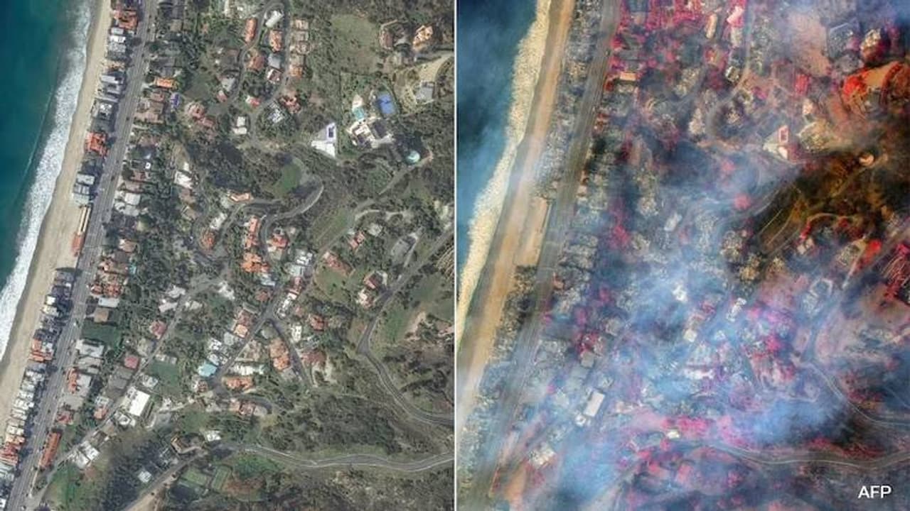
California's wildfires have devastated Los Angeles. Newly released satellite images from Maxar Technologies show the extent of the damage caused by the Palisades and Eaton fires. The area appears largely ashen, with thousands displaced.

Los Angeles Fire Damage
The Palisades and Eaton fires have burned 34,000 acres, making it one of Los Angeles' most destructive wildfires. Nearly 10,000 homes and structures were destroyed. Estimated losses range from $135 billion to $150 billion. President Biden declared a major disaster.
Los Angeles Fire Impact
LA County Sheriff described the scene as resembling a bombed area. Mayor Karen Bass pledged to rebuild. Governor Newsom deployed the National Guard for traffic control and evacuation zone security.
Pacific Palisades Devastation
The Pacific Palisades area has been devastated, with high-end homes destroyed. Images show the area before the Palisades fire on October 20, 2024, and after the fire on January 9, 2025.
Mount Wilson Observatory Saved
The fire threatened key infrastructure, including the Mount Wilson Observatory. Firefighters saved the observatory, though the surrounding area remains at risk. A new fire, the Kenneth fire, is growing rapidly.
Check the Breaking News Today and Latest News from across India and around the world. Stay updated with the latest World News and global developments from politics to economy and current affairs. Get in-depth coverage of China News, Europe News, Pakistan News, and South Asia News, along with top headlines from the UK and US. Follow expert analysis, international trends, and breaking updates from around the globe. Download the Asianet News Official App for reliable global news coverage anytime, anywhere.