- Home
- World
- What Is a Shelf Cloud? Terrifying Scenes Circulating On Social Media; Video Goes Viral (WATCH)
What Is a Shelf Cloud? Terrifying Scenes Circulating On Social Media; Video Goes Viral (WATCH)
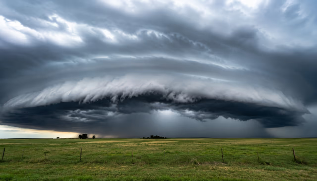
A dramatic shelf cloud stretching across the Mississippi skyline has gone viral, leaving viewers amazed by its cinematic appearance. Here's what a shelf cloud is, how it forms, and why it often signals an approaching thunderstorm
What Is a Shelf Cloud?
A breathtaking video of a giant shelf cloud moving across the horizon in Mississippi has gone viral on social media, with many comparing the scene to something straight out of a disaster movie. While the cloud's dramatic appearance has fascinated viewers worldwide, meteorologists say it is a well-known weather phenomenon that usually signals the arrival of a thunderstorm.
A shelf cloud, also known as an Arcus cloud, is a low-hanging, horizontal cloud that forms along the leading edge of a thunderstorm. It is easily recognized by its broad, wedge-shaped appearance, often stretching across the sky like a massive wall.
Although these clouds can appear intimidating and sometimes seem to rotate, the motion is usually caused by strong winds interacting with the storm system rather than the cloud itself spinning like a tornado. Shelf clouds are often among the first visible signs that a storm is approaching.
How Does a Shelf Cloud Form?
Shelf clouds develop when a thunderstorm pushes cold, dense air outward. As this cooler air spreads along the ground, it collides with the surrounding warm, humid air and forces it upward. The rising warm air cools rapidly, allowing moisture to condense into the distinctive shelf-shaped cloud.
This process occurs along the storm's gust front, creating a sharp cloud boundary that can stretch for several kilometres. People beneath a shelf cloud usually experience a sudden burst of cool, dry winds before rainfall begins once the cloud passes overhead.
Why Are Shelf Clouds Linked to Thunderstorms?
Shelf clouds are closely associated with thunderstorms because they form from the powerful downdrafts produced within these storms. A thunderstorm develops when warm, moisture-rich air rises into cooler layers of the atmosphere. As the air cools, water vapour condenses into cloud droplets, releasing energy that fuels the storm.
The continuous cycle of rising warm air and sinking cooler air, known as a convection cell, helps sustain thunderstorms. Since every thunderstorm produces lightning and thunder, the appearance of a shelf cloud often serves as a visual warning that stormy weather is about to arrive.
The spectacular Mississippi footage has once again highlighted how nature can produce breathtaking displays that appear almost unreal. While shelf clouds can look dramatic, they are a reminder to prepare for strong winds, heavy rain and lightning that frequently follow close behind.

Check the Breaking News Today and Latest News from across India and around the world. Stay updated with the latest World News and global developments from politics to economy and current affairs. Get in-depth coverage of China News, Europe News, Pakistan News, and South Asia News, along with top headlines from the UK and US. Follow expert analysis, international trends, and breaking updates from around the globe. Download the Asianet News Official App from the Android Play Store and iPhone App Store for accurate and timely news updates anytime, anywhere.