
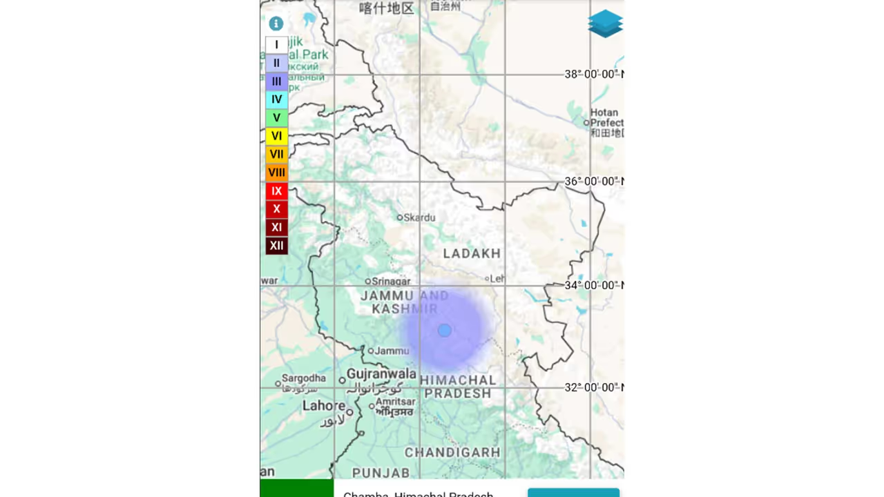
A magnitude 3.0 earthquake struck Chamba in Himachal Pradesh on Friday at 06:36 am, the National Centre of Seismology (NCS) reported. The quake occurred at a shallow depth of 5 km. The NCS provided the coordinates and confirmed the event on social media.
An earthquake of magnitude 3.0 struck Chamba in Himachal Pradesh on Friday, reported the National Centre of Seismology (NCS). The earthquake hit the district at 06:36 am. Sharing the details on its website, the NCS said, "M: 3.0 - Chamba, Himachal Pradesh, Origin Time: 2026-08-14 06:36:28 IST, Latitude: 33.131, Longitude: 76.585, Depth: 5 km."
In a post on X, NCS said: "EQ of M: 3.0, On: 14/08/2026 06:36:28 IST, Lat: 33.131 N, Long: 76.585 E, Depth: 5 Km, Location: Chamba, Himachal Pradesh." EQ of M: 3.0, On: 14/08/2026 06:36:28 IST, Lat: 33.131 N, Long: 76.585 E, Depth: 5 Km, Location: Chamba, Himachal Pradesh. For more information Download the BhooKamp App https://t.co/5gCOtjdtw0 @DrJitendraSingh @OfficeOfDrJS @DrNKalaiselvi @GSuresh_NCS @ndmaindia pic.twitter.com/vK4RMMP5XI — National Center for Seismology (@NCS_Earthquake) August 14, 2026
Understanding Earthquake Depths
Earthquakes can occur anywhere between the Earth's surface and about 700 kilometres below the surface. For scientific purposes, the earthquake depth range of 0 700 km is divided into three zones: shallow, intermediate, and deep, as per USGS data.
Shallow earthquakes are between 0 and 70 km deep; intermediate earthquakes, 70 -300 km deep; and deep earthquakes, 300 - 700 km deep.
In general, the term "deep-focus earthquakes" is applied to earthquakes deeper than 70 km, the United States Geological Survey (USGS) states. (ANI)
(Except for the headline, this story has not been edited by Asianet Newsable English staff and is published from a syndicated feed.)