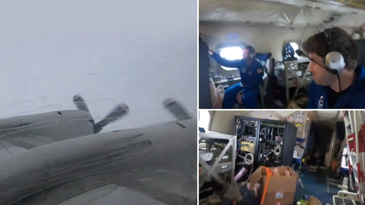
The US National Oceanic and Atmospheric Administration (NOAA) aircraft "Miss Piggy" battles severe turbulence while collecting critical data inside Hurricane Milton for storm forecasting.
The US National Oceanic and Atmospheric Administration (NOAA) Aircraft Operations Center has released dramatic video footage showing one of its research aircraft, a Lockheed WP-3D Orion dubbed "Miss Piggy," experiencing severe turbulence while flying directly into the eye of Hurricane Milton. The mission, undertaken as part of NOAA’s hurricane research efforts, captured the aircraft navigating through intense rainfall and violent weather conditions in a bid to gather vital data to enhance storm forecasting.

The video, which was shared on X (formerly Twitter) by the NOAA Aircraft Operations Center, shows the aircraft’s journey through a dense, gray sky as it is pounded by heavy rain and buffeted by strong winds. Inside the plane, researchers are seen enduring the turbulent conditions. In a tweet accompanying the footage, the NOAA team wrote, “Bumpy ride into Hurricane Milton on NOAA WP-3D Orion,” highlighting the extreme conditions the aircraft encountered.
Among the onboard team was Electrical Engineer Tom Brannigan, seated at the AVAPS (Airborne Vertical Atmospheric Profiling System) console, who is seen holding steady as the plane shudders violently. At one point, the turbulence causes a plastic bag tied to a nearby shelf to spin out of control, spilling its contents onto the cabin floor. During the rocky flight, Programs Integration Engineer Nick Underwood, who was filming the footage, can be heard asking, "Can you grab my phone real quick?" as the intensity of the turbulence increased.
NOAA’s aircraft, built in the mid-1970s, has been critical to gathering data on hurricanes over several decades. According to Susan Buchanan, Director of Public Affairs for the National Weather Service, the mission was aimed at measuring key atmospheric variables within the storm, such as central pressure and wind speed near the eye of Hurricane Milton. Buchanan emphasized the importance of locating the storm’s center and measuring surface winds to improve forecasting models. This data is transmitted to the National Hurricane Center (NHC) to help track the storm’s progression and predict its potential impact on land.
The NHC, using the information collected during the flight, warned that Hurricane Milton had the potential to be one of the most destructive storms to hit west-central Florida in recent history. Milton was expected to make landfall late Wednesday night near Tampa on Florida’s west coast. However, meteorologists cautioned that predicting the exact landfall location remained challenging, even within a 24-hour window.
With its growing strength, Milton threatens significant damage, and residents across Florida’s Gulf Coast have been urged to brace for possible catastrophic impacts, including powerful winds, flooding, and storm surges. As preparations continued along the coast, forecasters reiterated that "Milton has the potential to be one of the most destructive hurricanes on record for west-central Florida."
