Jammu & Kashmir LATEST Weather Update: Snow and Rain Hit the Valley as Winter Chill Intensifies
Jammu & Kashmir is set for snow and rain from 22 January as Western Disturbances approach. Winter chill intensifies, especially in high-altitude areas, while residents are advised to stay cautious and monitor weather updates.
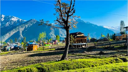
Jammu and Kashmir is experiencing a shift in weather from 22 January as two Western Disturbances approach the region. These systems are expected to bring widespread precipitation across the UT, affecting both lowland and mountainous areas. The most intense weather, including heavy snow and rain, is forecast for 23 January, particularly in high-altitude zones.
Stay updated with the Breaking News Today and Latest News from across India and around the world. Get real-time updates, in-depth analysis, and comprehensive coverage of India News, World News, Indian Defence News, Kerala News, and Karnataka News. From politics to current affairs, follow every major story as it unfolds. Get real-time updates from IMD on major cities weather forecasts, including Rain alerts, Cyclone warnings, and temperature trends. Download the Asianet News Official App from the Android Play Store and iPhone App Store for accurate and timely news updates anytime, anywhere.