Chennai Weather LATEST Update: Widespread Rains Expected in Tamil Nadu as Bay of Bengal System Develops
Chennai Weather LATEST Update: A developing low-pressure area over the Bay of Bengal may lead to a cyclone next week, but its track remains uncertain. Tamil Nadu, however, is set to receive widespread rainfall
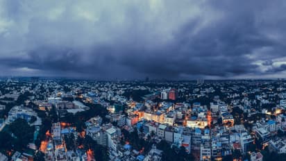
Weather trackers noted that the possible cyclone’s movement will largely depend on the exact location where the late-November low-pressure area develops. They explained that even minor shifts in this genesis point can result in significant changes to the eventual track.
Stay updated with the Breaking News Today and Latest News from across India and around the world. Get real-time updates, in-depth analysis, and comprehensive coverage of India News, World News, Indian Defence News, Kerala News, and Karnataka News. From politics to current affairs, follow every major story as it unfolds. Get real-time updates from IMD on major cities weather forecasts, including Rain alerts, Cyclone warnings, and temperature trends. Download the Asianet News Official App from the Android Play Store and iPhone App Store for accurate and timely news updates anytime, anywhere.