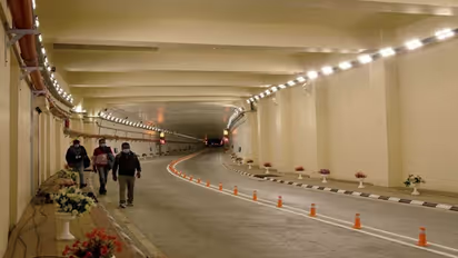
Atal Tunnel to aid Army against Chinese aggression along Leh-Ladakh

First Published Oct 3, 2020, 1:00 PM IST

Atal tunnel plays a significant role in Indo-China strategic positioning. On one side, communication between Lahul-Spiti and Leh-Ladakh will be easier and on the other hand, communication with the army in this area will also be simpler. The Atal Tunnel will give a big push to the army to counter Chinese aggression.
 

Lahul-Spiti: Those who are familiar with cold desert mountain know what region has to offer. The mountains are extremely rough but smooth and in winter covered in glaciers. Lahul-Spiti has a big role to play in India's strategic position with China. The border of Tibet starts as soon as the Lahul-Spiti border is crossed. As a result, the Chinese border is close to Lahul-Spiti. On the other hand, Leh-Ladakh is connected with Lahul Spiti.
undefined
Lahul-Spiti has been in contact with the mainland for only 6 months. The Lahul-Spiti road is open from June to November. The main road to enter this area known as the Cold Desert Mountain in the Himalayas is through the Rohtang Pass. As a result, we have to wait for the month of June again, because the road is only open to Lahul-Spiti if the snow melts or dredging is possible. There are some connecting roads avoiding the Rohtang Pass, but most of them are hilly roads on foot. There is also a road from Shimla to Spiti via Kinnar, but it is completely covered in snow, and the risk of driving on that road is also high. Getting to Lahul becomes virtually impossible even if you enter Spiti in winter through that road to Kinnar. At that time, such a strategic location of India with China became completely inaccessible due to the weather. The steady tunnel will cut short the distance.
undefined
The Atal tunnel was built through the Pir-Panjal valley of Rohtang Pass, which established a 24X7 communication system with Lahul-Spiti. Due to the Atal Tunnel, the time to reach Lahul-Spiti from Manali via Rohtang Pass has been reduced to 6 hours. Atal Tunnel will take about 2 hours instead of 8 hours because it has bypassed 46 km of road. It took up to three hours for any vehicle to cross this 48 km road through Rohtang Pass until now.
undefined
The height of the Atal Tunnel is 10,171 feet above sea level. The height of the Rohtang Pass is 13,051 feet above sea level. The Atal Tunnel cuts through the heart of Rohtang to a village called Gramphu, which lies on the top of the Manali-Leh road and locally falls within the Lahul-Spiti district.
undefined
Spiti is located on one side of the Atal Tunnel and Leh-Ladakh on the other side.
undefined
The Indian Army has had strategic positions at numerous locations in Leh-Ladakh and Lahul-Spiti for many years. These army outposts and camps are very important to India to prevent Chinese aggression. The Atal Tunnel, Lahul-Spiti, and Leh-Ladakh will now be connected to the rest of the country throughout the year. All annual supplies will also reach the army in Leh-Ladakh and Lahul-Spiti through the Atal tunnel.
undefined
There are two roads to reach Leh-Ladakh, one passing through Jozilla Pass through Kashmir and the other through Rohtang from Manali to Lahul-Spiti. There is a risk of communication being cut off through the Jozilla Pass due to snowfall in winter. Road connectivity with Lahul-Spiti and Leh-Ladakh became stronger as the journey through the Atal Tunnel began. Not only to prevent the infiltration of external enemies, the Atal Tunnel will also play an important role in the development of tourism in the region.
undefined
click me!