Satellite imagery shows Chinese troops dismantling positions in Depsang, allowing Indian troops access to previously blocked patrol routes, with further talks planned on buffer zones in eastern Ladakh.
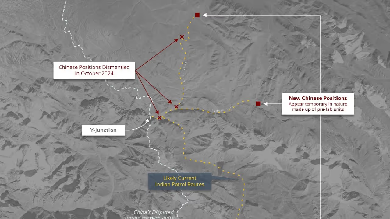
New Delhi: Over 1 and a half months after the announcement of disengagement and the commencement of patrolling at the two friction points in Ladakh—Depsang and Demchok—satellite imagery shows that Chinese troops have dismantled three positions and relocated to new areas across the Depsang bulge.

The imagery suggests that the structures were temporary, likely made from prefabricated units.
As a result of this development, Indian troops now have access to previously blocked patrol routes.
The latest satellite images reveal the dismantling of structures at three positions, including the Y-Junction in the Depsang Sector.
“In a first, The PLA has moved back from Depsang bulge Y junction/ Bottle neck at Raki Nala , by approx 20 kms, dismantling their posts and giving access to the patrol points to Indian Army. Strategic patience and resolve has paid dividends,” former Indian Army director general of military operations (DGMO) Lt Gen Vinod Bhatia said in a post on X.
According to officials, the two sides have implemented the disengagement measures announced on October 21. The next round of talks will focus on the buffer zones created at other friction points in eastern Ladakh.
India's National Security Advisor, Ajit Doval, and China's State Councillor, Wang Yi, are expected to meet at the end of this month to discuss pending issues in other areas of Ladakh.
