Govt ensures transparency in railway land development: Ashwini Vaishnaw
Synopsis
Railways Minister Ashwini Vaishnaw says the govt has created a transparent, tender-based system for commercial and housing development on railway land via the RLDA, contrasting with stalled, non-transparent processes during the UPA government.
Ensuring Transparency in Land Development
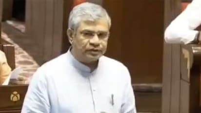
Union Railways Minister Ashwini Vaishnaw on Friday highlighted the government's efforts to ensure transparency in railway land development. Speaking in the Rajya Sabha, he noted that the Railway Land Development Authority (RLDA), established several years ago, had its work largely stalled due to non-transparent processes during the UPA government. In recent years, however, the government has introduced a fully transparent, tender-based system for utilising railway land for commercial and housing projects.
"Over the last few years we have been able to create a very transparent mechanism. We tried multiple ways. Railways has an authority called the Railway Land Development Authority. That authority was created many years ago. But somehow, in between, during the UPA government, many steps were taken which were not very transparent. So practically that work almost got stopped. But in recent times very transparent methods have been created in a very authentic tender-based mechanism where the land is then used for commercial development or housing development," said Vaishnaw.
Tackling Encroachments with Technology
Vaishnaw also highlighted the use of advanced technology to address encroachments, with satellite imagery and drone-based surveys generating updated maps that are compared against reference maps of the entire railway network. AI and other algorithms are then applied to detect new encroachments, enabling prompt action. While fresh encroachments have significantly declined, the challenge remains with long-standing encroachments that have existed for decades.
"We are using two basic technologies. One is satellite technology and secondly, drone-based survey. Both of these are producing maps, which are then compared with the reference maps that we have for the entire network. Based on those reference maps, we are able to use AI and other algorithms to find out if any new encroachments have happened and then we are able to take immediate steps. Fresh encroachment has significantly reduced...The problem is more of the encroachment, which has been there for many decades now," said Vaishnaw. (ANI)
Stay updated with the Breaking News Today and Latest News from across India and around the world. Get real-time updates, in-depth analysis, and comprehensive coverage of India News, World News, Indian Defence News, Kerala News, and Karnataka News. From politics to current affairs, follow every major story as it unfolds. Get real-time updates from IMD on major cities weather forecasts, including Rain alerts, Cyclone warnings, and temperature trends. Download the Asianet News Official App from the Android Play Store and iPhone App Store for accurate and timely news updates anytime, anywhere.