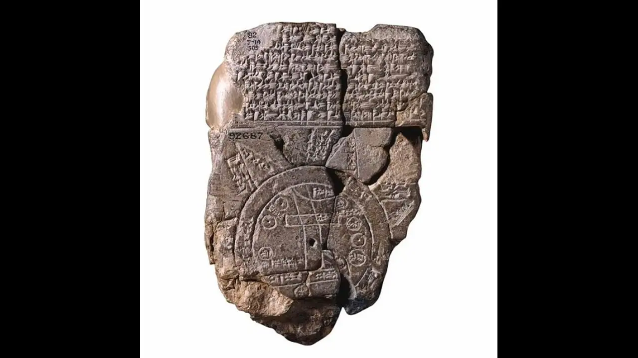
Hailing from the venerable city of Abu Habba (modern-day Sippar) in Iraq, this clay tablet, dating to the sixth century B.C., stands as the earliest known map of the ancient world.
In a revelation that bridges millennia, the Babylonian Map of the World, or "Imago Mundi," has emerged as a dazzling relic of ancient geography. Hailing from the venerable city of Abu Habba (modern-day Sippar) in Iraq, this clay tablet, dating to the sixth century B.C., stands as the earliest known map of the ancient world.

Crafted with meticulous precision, the map portrays the ancient realm as a circular disc encircled by the Bitter River, a mythical body of water. At its heart lies the Euphrates River, and prominently featured is the illustrious city of Babylon. The map’s cuneiform inscriptions mark various locations, providing an invaluable glimpse into the geographical understanding of ancient Babylonians. Intriguingly, "Babylon" is inscribed at one terminus of the Euphrates River, even though its historical locus straddled both banks.
Mythological Insights and Historical Context
Above this cartographic marvel, a block of text narrates the cosmological genesis orchestrated by Marduk, the paramount deity of Babylonia. This text interweaves the creation myth with mentions of legendary creatures and sovereigns such as Utnapishtim, who famously weathered a cataclysmic deluge. On the tablet’s reverse, eight peripheral regions, known as nagu, are delineated with brief but evocative descriptions.
Standing at 4.8 inches tall and 3.2 inches wide (12.2 by 8.2 centimeters), this artifact is a prized possession of The British Museum, offering a tangible link to the ancient Babylonian understanding of the cosmos and their pioneering cartographic techniques.
A Modern Revelation: Recent Discoveries and Public Engagement
In a recent showcase, the British Museum has brought the Babylonian Map of the World into contemporary consciousness through a compelling video narrated by Irving Finkel, an esteemed philologist and curator in the museum’s Middle East department. This cinematic exploration delves into the map’s historical significance and the intricate process of reconstructing its fragmented sections.
The video has elicited widespread acclaim, with viewers praising Finkel’s enthralling narration and the educational depth of the presentation. Public reactions on YouTube underscore a deep fascination with the map and an appreciation for its historical and cultural resonance.

The Babylonian Map of the World continues to be an indispensable artifact, offering profound insights into the cartographic and cosmological perspectives of ancient Babylon. It stands not only as a relic of the past but also as a beacon of our enduring quest to understand the ancient world.
