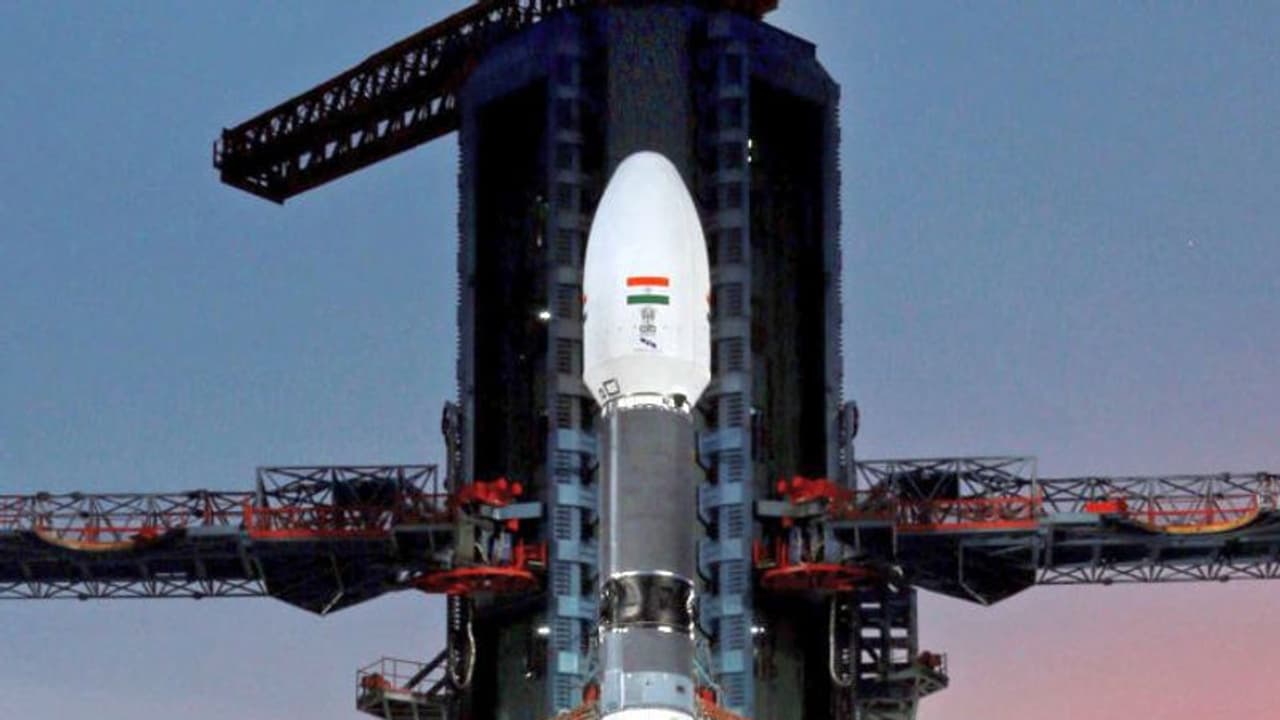
NVS-01 is equipped with advanced navigation payloads in L1, L5, and S bands. Notably, a remarkable addition to this second-generation satellite is the indigenous development of a rubidium atomic clock, marking a significant milestone in Monday's launch. Girish Linganna reports
The Indian Space Research Organisation launched a navigation satellite into space aboard a GSLV rocket. The second-generation navigation satellite NVS-01 took off from the second launch pad at the renowned Satish Dhawan Space Centre (SHAR) located in Sriharikota, Andhra Pradesh. This eagerly anticipated mission showcases ISRO's unwavering commitment to advancing space exploration and navigation technology.

With this launch, the ISRO achieved an essential objective: the continuity of NavIC (Navigation with Indian Constellation) services. NavIC is an indigenous regional satellite navigation system, akin to GPS, that offers precise and real-time navigation capabilities within India.
By leveraging NavIC signals, users can obtain remarkably accurate positioning information, surpassing the 20-meter threshold, along with exceptionally precise timing accuracy, better than 50 nanoseconds. This momentous event heralds a significant stride forward in empowering India with cutting-edge navigation technology.
Embarking on its 15th mission, the Geosynchronous Satellite Launch Vehicle (GSLV), standing tall at 51.7 meters, ferried the navigation satellite NVS-01, weighing a substantial 2,232 kg. Following a flight duration of approximately 20 minutes, the GSLV will gracefully release the satellite into a Geosynchronous transfer orbit (GTO) at an altitude of around 251 km, as confirmed by ISRO.
NVS-01 is equipped with advanced navigation payloads in L1, L5, and S bands. Notably, a remarkable addition to this second-generation satellite is the indigenous development of a rubidium atomic clock, marking a significant milestone in Monday's launch. ISRO proudly announced the pioneering use of an indigenously crafted rubidium atomic clock, underscoring India's remarkable technological achievements in space exploration.
Previously, scientists relied on imported rubidium atomic clocks to ascertain precise date and location information. However, in a remarkable stride towards self-reliance, the Indian Space Research Organisation (ISRO) proudly announces the inclusion of an indigenously developed rubidium atomic clock for this mission.
Crafted by the talented team at the Space Applications Centre in Ahmedabad, this homegrown technological marvel will now be on board the satellite, further showcasing India's prowess in cutting-edge space research and development. With this significant advancement, ISRO underscores its commitment to fostering indigenous innovation and reducing dependencies on external sources.
The significance of this technology cannot be understated, as only a select few countries possess it. Recognizing the need to fulfil India's positioning, navigation, and timing requirements, especially in the realms of civil aviation and military operations, the Indian Space Research Organisation (ISRO) developed the Navigation with Indian Constellation (NavIC) system.
Previously known as the Indian Regional Navigation Satellite System (IRNSS), NavIC stands at the forefront of cutting-edge navigation technology. Its L1 navigation band is widely acclaimed for delivering precise position, navigation, and timing services to civilian users, while also enabling interoperability with other global navigation satellite systems (GNSS) signals.
NavIC finds its versatile applications across various domains, including terrestrial, aerial, and maritime navigation, precision agriculture, mobile-based location services, and marine fisheries, among a multitude of others. This remarkable system comprises a constellation of seven satellites working in perfect harmony with a dedicated network of ground stations, ensuring uninterrupted functionality 24x7.
NavIC offers two distinct services to cater to diverse user needs. The Standard Position Service (SPS) is specifically designed for civilian users, while a Restricted Service caters to strategic users. Notably, NavIC SPS signals are seamlessly interoperable with signals from renowned global navigation satellite systems like GPS from the United States, Glonass from Russia, Galileo from the European Union, and BeiDou from China. This interoperability enhances the overall accuracy and reliability of navigation data.
The upcoming launch marks the sixth operational flight of the GSLV featuring an indigenous cryogenic stage. The NVS-01 satellite, set to embark on this mission, is expected to serve for over 12 years, reaffirming its robustness and longevity. NavIC continues to revolutionize the realm of navigation and positioning, empowering various sectors with its cutting-edge capabilities and reinforcing India's technological prowess in the global space arena.
