India rebuffs China's Ladakh claims, calls them 'entirely baseless'
Synopsis
India firmly rebuffed China's claims over Ladakh, stating the UT is an integral and inalienable part of the nation. The MEA dismissed Beijing's objections to India's new cartographic updates standardizing 28 locations as 'entirely baseless'.
India has delivered a robust and unyielding counter-rebuttal to Beijing’s persistent claims over Ladakh, firmly underscoring that the Union Territory is a permanent and sovereign component of the nation while dismissing external objections as entirely baseless. The sharp diplomatic exchanges erupted after Beijing raised objections to India's recent cartographic updates.
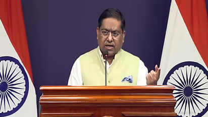
Addressing media inquiries regarding the Chinese statements, Ministry of External Affairs (MEA) spokesperson Randhir Jaiswal stated, "It is reiterated that the UT of Ladakh is an integral and inalienable part of India. No amount of denial by the Chinese side can change this established fact." The diplomatic friction followed an official notification by India's Ministry of Home Affairs (MHA) standardising the names of 28 strategic locations and geographical features across Ladakh on official cartography.
Beijing Protests Cartographic Updates
Weighing in on the announcement, Chinese Foreign Ministry spokesperson Mao Ning alleged that Beijing had never recognised the territory, claiming the measure was unilaterally enacted. Asserting opposition to the move, Mao stated, "The move is illegal and invalid and cannot change the fact that the relevant areas in the western sector of the China-India boundary have always belonged to China."
India's Firm Rebuttal
Refuting Beijing's protests, the MEA spokesperson emphasised that the official press statement was self-explanatory. Jaiswal clarified that the initiative encompasses 28 distinct sites and physical features situated within the Union Territory of Ladakh, which now bear standard designations on the official Survey of India maps.
According to the spokesperson, these geographical names were settled following close consultations with the local administration of the Union Territory of Ladakh and regional stakeholders. Elaborating further, the MEA stated, "The announcement mentions that the twenty-eight (28) places/features located in the UT of Ladakh have been identified with standard place and feature names on the official map of Survey of India, and it has been done in consultation with the Union Territory of Ladakh and local stakeholders. Identifying these places formally on the Survey of India map of UT of Ladakh is aimed at facilitating their accurate recognition and better awareness among the public at large."
Updated Cartography Includes Key Friction Points
The updated cartography, formally adopted on October 2, includes vital frontier friction points along the Line of Actual Control (LAC), such as Gogra and Hot Spring, both significant sites from the 2020 military standoff that began following clashes near Pangong Lake, alongside other prominent landmarks. These include Alisha Giri, Brangsa, Chapchingal Pass, Kanishka Peak, Karun Pir mountain, Kuksel, Martand Giri, Parpik Glacier, Skamri Glacier, Shachmirik Pass, Shkorga Valley, Zorawar Peak, Dehra Compass, Drak Karpo, Jolmori, Kumarayana Point, Panglung, Rinchen Zangpo, Sakyasri Giri, Guru Rinpoche, Shamal Lungpa, Yangpa River, Marpa Lotsava Ri, Milarepa Kangri, Shiva Ri and Maheshwara Ri. (ANI)