Andhra Pradesh, Telangana Weather LATEST Update: Coastline Faces Cyclone Akvan Threat
Synopsis
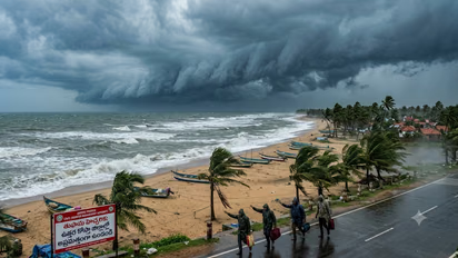
Andhra Pradesh, Telangana Weather LATEST Update: Cyclone Akvan is gathering strength over the Bay of Bengal, raising concerns along India's eastern coastline. With Andhra Pradesh emerging as a possible landfall region, Tamil Nadu and neighbouring states are also monitoring the developing storm
India's eastern coastline is preparing for another spell of turbulent weather as a developing system over the Bay of Bengal gains strength. The India Meteorological Department (IMD) has been tracking a depression over the southeast and adjoining southwest Bay of Bengal, which is expected to intensify into Cyclone Akvan.
According to the latest weather forecast, the system is likely to move north-northwestwards and strengthen into a cyclonic storm on November 16. It is subsequently expected to intensify into a severe cyclonic storm over the west-central Bay of Bengal around November 17.
The storm is then likely to continue moving towards the Andhra Pradesh coastline over the following two days. If it develops as forecast, Akvan will become the third cyclone to affect the North Indian Ocean region during the post-monsoon season, following Cyclones Arnab and Murasu.
Andhra Pradesh Coast Under Watch As Landfall Possibility Emerges
Andhra Pradesh is emerging as a possible landfall region as Cyclone Akvan continues its projected north-northwesterly movement. Weather forecasts indicate that the system could approach the state's coastline around November 19-20.
Some projections suggest that the storm could cross the Andhra Pradesh coast between Visakhapatnam and Bapatla. However, the IMD has not yet officially confirmed the precise landfall location, and its eventual trajectory will depend on how the system develops over the coming days.
The approaching cyclone is also expected to trigger strong winds and intense rainfall across coastal districts. Wind speeds could reach 90-100 kmph, with gusts potentially touching 110 kmph in parts of coastal Andhra Pradesh.
Several districts, including Srikakulam, Vizianagaram, Visakhapatnam, Anakapalli, Kakinada, East Godavari, West Godavari, Eluru, Krishna and Bapatla, could experience heavy to very heavy rainfall on November 19 and 20.
Authorities are closely monitoring the situation, particularly because strong winds and rough sea conditions could affect fishing activities and damage standing crops.
Will Cyclone Akvan Bring Heavy Rain To Tamil Nadu?
While Andhra Pradesh remains under close watch, questions are also being raised about the possible impact of Cyclone Akvan on Tamil Nadu.
According to the available forecasts, Tamil Nadu is unlikely to experience the storm's direct impact if it follows the projected north-northwesterly route towards Andhra Pradesh. The state's rainfall activity is expected to remain relatively subdued until November 20.
However, isolated parts of southern Tamil Nadu and the Western Ghats districts could receive light to moderate rainfall. Chennai and its neighbouring areas may also experience occasional light showers.
Weather experts are continuing to monitor the cyclone's movement, as even a slight change in its trajectory could influence rainfall patterns along the Tamil Nadu coastline.
The IMD is expected to provide greater clarity about the storm's movement and possible landfall as the system intensifies. Fishermen have also been advised to exercise caution and avoid venturing into the sea during periods of rough weather.
For now, Andhra Pradesh remains the primary region of concern, while neighbouring coastal states continue to monitor Cyclone Akvan's development.
Stay updated with the Breaking News Today and Latest News from across India and around the world. Get real-time updates, in-depth analysis, and comprehensive coverage of India News, World News, Indian Defence News, Kerala News, and Karnataka News. From politics to current affairs, follow every major story as it unfolds. IMD cities weather forecastsRain Cyclone Asianet News Official App