Monsoon ends in Himachal with 11% rain deficit, withdraws 8 days late
Synopsis
Himachal Pradesh saw an 11% monsoon rainfall deficit this year, with the Southwest Monsoon withdrawing eight days later than usual. Lahaul-Spiti had the highest deficit at 65%, while some districts received excess rain.
The hill state of Himachal Pradesh recorded an 11 per cent deficit in monsoon rainfall this year, with Lahaul-Spiti registering the highest shortfall of 65 per cent, while the Southwest Monsoon withdrew from the state eight days later than its normal date, the India Meteorological Department (IMD) said.
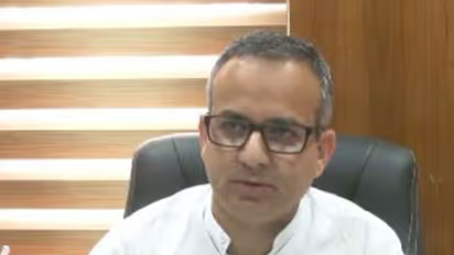
The Southwest Monsoon completely withdrew from Himachal Pradesh on October 3 against its normal withdrawal date of September 25, marking a delay of around eight days, Sandeep Kumar Sharma, Senior Scientist, IMD, said while speaking to ANI in Shimla. “Overall, Himachal Pradesh received around 11 per cent less rainfall than normal during the monsoon season. The monsoon arrived late as well as withdrew late this year. It entered the state on June 30 and covered the entire state by July 1, against its normal arrival around June 24,” Sharma said on Monday.
District-wise Rainfall Data
According to the IMD, Lahaul-Spiti recorded the maximum rainfall deficiency at 65 per cent below normal, followed by Hamirpur with a 34 per cent deficit. Mandi and Solan recorded around 14 per cent less rainfall than normal. In contrast, some districts recorded excess rainfall during the season. Kinnaur received around 18 per cent above-normal rainfall, while Shimla recorded around 16 per cent more rainfall than normal. Rainfall in most of the remaining districts remained close to normal.
Current Weather and Temperatures
Sharma said weather remained mainly clear across the state during the past 24 hours, with day temperatures remaining above normal in several pockets. “Shimla recorded a maximum temperature of around 25 degrees Celsius, while temperatures were around 32 degrees in Una and adjoining areas. The highest maximum temperature of around 34 degrees Celsius was recorded in Una,” he said.
Day temperatures were around two to three degrees above normal in several parts of the state, while Kalpa recorded maximum temperatures in the range of six to nine degrees Celsius.
Weather Forecast for Coming Days
The IMD has forecast mainly clear weather across Himachal Pradesh on October 5, but weather activity is likely to increase from the night of October 6. “From the night of October 6 and particularly during the early morning of October 7, thunderstorms accompanied by light rainfall are likely in Kangra, Una, Bilaspur, Shimla and Mandi districts. Some areas may also receive moderate rainfall,” Sharma said.
He said the weather system would continue to influence parts of the state on October 8 and 9, particularly the central districts, where isolated spells of light to moderate rainfall accompanied by thunderstorms are expected. “From October 10, there is likely to be a significant reduction in weather activity across the state,” he said.
The IMD has also indicated the possibility of snowfall in the higher reaches of Kangra, Kullu and Lahaul-Spiti during the upcoming weather activity. Sharma, however, said that snowfall reports from higher reaches would depend on local conditions and observations from individual weather stations. “The main impact of the upcoming weather activity is likely to be over Kangra, Bilaspur, Una, Hamirpur, Shimla, Solan and Mandi. Thunderstorms with light rainfall are expected in these areas, while the higher reaches may experience light snowfall,” he said.
The IMD scientist said the weather system would primarily affect the mid-hill and lower-lying districts, while higher elevations could see a mix of light rain and snowfall depending on altitude and local conditions. (ANI)
(Except for the headline, this story has not been edited by Asianet Newsable English staff and is published from a syndicated feed.)Stay updated with the Breaking News Today and Latest News from across India and around the world. Get real-time updates, in-depth analysis, and comprehensive coverage of India News, World News, Indian Defence News, Kerala News, and Karnataka News. From politics to current affairs, follow every major story as it unfolds. IMD cities weather forecastsRain Cyclone Asianet News Official App