ISRO PSLV-C56 launch: Meet DS-SAR and its six co-passengers
Synopsis
ISRO is preparing for the PSLV-C56 mission, scheduled for launch from Sriharikota on July 30. Besides the DS-SAR satellite, the PSLV-C56 mission will also include six other co-passenger satellites from Singapore. Defence, Aerospace analyst Girish Linganna explains
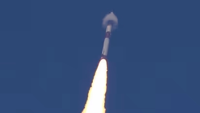
The Indian Space Research Research Organisation is gearing up for an exciting launch at 6.30 am on July 30 from the Satish Dhawan Space Centre in Sriharikota. The PSLV-C56 mission will carry the DS-SAR satellite, a significant payload for Singapore, along with six other important co-passenger satellites -- all from Singapore, each with its own unique objectives and missions. This is the 58th flight of the PSLV and the 17th flight of PSLV in its core-alone configuration. The core-alone configuration means that the PSLV is launched without its six strap-on boosters. This configuration is used for missions with smaller payloads.
The DS-SAR satellite is a joint creation by the DSTA and ST Engineering, representing the Singaporean government. It weighs around 352 kg and is equipped with a state-of-the-art Synthetic Aperture Radar (SAR) payload from Israel Aerospace Industries (IAI). This advanced technology enables the DS-SAR to deliver unparalleled imaging capabilities in all weather conditions, day and night. The satellite’s remarkable 1m-resolution imaging at full polarimetry is set to revolutionize remote-sensing applications.
What is Synthetic Aperture Radar?
Synthetic Aperture Radar (SAR) is a type of radar technology that creates high-resolution images by using the motion of the radar antenna to simulate a much larger antenna; hence, the term ‘synthetic aperture’. This allows SAR systems to achieve fine resolution and excellent imaging capabilities, making them highly valuable for remote-sensing applications, especially in challenging weather conditions and low-light environments.
Here, the radar antenna moves along a specific path, usually on the satellite or aircraft carrying the radar system. This movement creates the effect of having a much larger antenna, which enables the SAR to achieve higher-resolution imaging than what would be possible with a physically larger, stationary antenna.
The DS-SAR satellite’s notable feature is its deployment into a Near Equatorial Orbit (NEO) at a 5-degree inclination and an altitude of 535 kilometres. The NEO is a type of orbit that is relatively close to Earth’s surface.
In this orbit, the satellite follows a path that is nearly aligned with Earth’s equator. This specific orbit and altitude allow the satellite to provide crucial satellite imagery for various government agencies in Singapore. The proximity to Earth enables the satellite to capture high-resolution images with great detail and efficiency, making it an essential tool for fulfilling Singapore’s diverse imaging needs.
The PSLV-C56 mission includes a variety of satellites from different organizations, highlighting the teamwork and cooperation in space exploration.
6 Co-Passenger Satellites
1) VELOX-AM, a 23-kg microsatellite, was developed by the Nanyang Technological University (NTU) in Singapore. VELOX-AM will carry AM-produced parts and payloads into space to test their performance in the harsh environment of space. The data collected from the VELOX-AM will help improve the design and performance of AM-produced parts for future space missions
2) ARCADE is a 27-unit (U), 24-kg CubeSat designed and built by Nanyang Technological University (NTU) in Singapore, in collaboration with the International Satellite Program in Research and Technology (INSPIRE) consortium. A CubeSat is a type of small satellite that is standardized to be 10 cm x 10 cm x 10 cm in size. Its 27-U designation means that ARCADE is a CubeSat made up of 27 individual cubes, each of which is 10 cm x 10 cm x 10 cm. This makes ARCADE a relatively large CubeSat and this allows it to carry a variety of scientific instruments and payloads. ARCADE uses an iodine-based propulsion system to maintain its orbit in Low-Earth Orbit (LEO). The propulsion system is based on a Hall-effect thruster, which is a type of electric propulsion system.
Iodine-based solid propellant propulsion module: This refers to the type of propulsion system that ARCADE uses. The propellant is a solid mixture of iodine and another compound and is ignited to create thrust.
Based on a Hall-effect thruster: This means that the propulsion system uses a Hall-effect thruster to generate thrust. A Hall-effect thruster is a type of electric propulsion system that uses an electric field to create thrust.
3) SCOOB-II, a 4-kg 3U Cube satellite, was designed and developed by a team of students of Nanyang Technological University (NTU) in Singapore. The satellite is about the size of a shoebox and is designed to last 6 months in orbit. SCOOB-II uses a three-axis controlled reaction wheel assembly to control its attitude, or orientation, in space.
4) NuLIoN is a 3-kg 3U Cube satellite developed by NuSpace. It is about the size of a shoebox and is designed to provide continuous LoRaWAN IoT services. LoRaWAN is a low-power, wide-area network (LPWAN) technology that is used to connect IoT devices. NuLIoN will be the first satellite in a constellation of satellites that will provide LoRaWAN services to IoT devices in the equatorial region.
Internet of Things: Physical objects embedded with sensors, software and network connectivity to collect and exchange data. Example: Connected cars that can automatically brake if they sense an impending collision; Wearable devices that track your fitness and health data.
5) Galassia-2 is a 3.5 kg 3U nano-satellite developed by students at the National University of Singapore (NUS). It is about the size of a shoebox and it is designed to perform an inter-satellite link (ISL) with TeLEOS-1. Galassia-2 will also demonstrate the capability of using Commercial Off-the-Shelf (COTS) multispectral imagery for space applications.
TeLEOS-1 is a commercial Earth observation satellite developed and operated by ST Electronics (STEE) in Singapore. It was launched on December 16, 2015, aboard a PSLV-C29 rocket from the Satish Dhawan Space Centre in India.
Commercial Off-the-Shelf (COTS) multispectral imagery for space application means it will use the images taken to study Earth’s surface and monitor changes over time by other satellites, thus saving costs. The imagery could also be used to support a variety of other applications, such as disaster management and environmental monitoring.
6) ORB-12 STRIDER: A global collaboration coordinated by Singapore-based ALIENA developed the ORB-12 STRIDER. It is designed to demonstrate next-generation propulsion systems for small satellite constellations. It will carry the world’s first Multi-modal all-Electric Propulsion Engine (MEPE). The MEPE will allow ORB-12 STRIDER to perform a variety of manoeuvres in space. The MEPE is more efficient than traditional propulsion systems.
Stay updated with the Breaking News Today and Latest News from across India and around the world. Get real-time updates, in-depth analysis, and comprehensive coverage of India News, World News, Indian Defence News, Kerala News, and Karnataka News. From politics to current affairs, follow every major story as it unfolds. Get real-time updates from IMD on major cities weather forecasts, including Rain alerts, Cyclone warnings, and temperature trends. Download the Asianet News Official App from the Android Play Store and iPhone App Store for accurate and timely news updates anytime, anywhere.