Delhi Monsoon Arrival Delayed: Southwest Monsoon Now Expected in Early July
Delhi Monsoon Arrival Delayed: Delhi may have to wait until early July for the arrival of the southwest monsoon as the absence of a crucial Bay of Bengal weather system has slowed its advance, even as rainfall deficits continue to grow
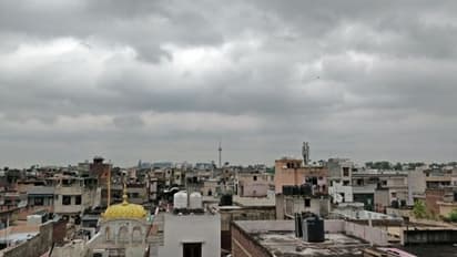
The southwest monsoon is expected to reach Delhi during the first week of July instead of its usual arrival around June 27. Weather experts say the delay is being caused by the non-formation of a favourable low-pressure system over the Bay of Bengal, which normally develops in mid-June and helps drive moisture-laden winds towards northern India.
According to meteorologists, a new weather system may form around June 25-26. Once it develops, monsoon currents are expected to regain momentum and advance towards northwest India, including the national capital.
Stay updated with the Breaking News Today and Latest News from across India and around the world. Get real-time updates, in-depth analysis, and comprehensive coverage of India News, World News, Indian Defence News, Kerala News, and Karnataka News. From politics to current affairs, follow every major story as it unfolds. Get real-time updates from IMD on major cities weather forecasts, including Rain alerts, Cyclone warnings, and temperature trends. Download the Asianet News Official App from the Android Play Store and iPhone App Store for accurate and timely news updates anytime, anywhere.